Historical News
Fixed Site Network
Phillipsdale
This week at Phillipsdale, data revealed good water quality. Over the course of the week there were only trace amounts of rainfall and flow from the Blackstone River decreased as compared to the prior week. Surface salinities were still quite low and remained below 6.0 psu for most of the week. Overall, surface salinity averaged 2.5 psu with a minimum of 0.9 psu, and a maximum of 6.4 psu. Bottom salinity fluctuated with the tides over the course of the week with an average of 11.4 psu and a range of 1.2 psu – 26.1 psu. Surface and bottom temperatures increased considerably by approximately 3-4oC as compared to last week with surface temperatures averaging 15.5oC with a range of 11.7oC – 19.4oC and bottom temperatures averaging 13.0oC and ranged between 8.4oC – 19.2oC. Surface chlorophyll was relatively low though did increase over the week with a weekly average of 1.3 ug/L, with a daily average peak of about 4.5 ug/L. Dissolved oxygen (DO) for the week was very good at both the surface and the bottom though slightly decreased from previous weeks; surface DO had an average of 10.1 mg/L and a range of 8.6 mg/L – 11.5 mg/L. Dissolved oxygen in the bottom waters had a weekly average of 9.0 mg/l and ranged from a minimum of 7.0 mg/L to a maximum of 11.2 mg/L. Note that tidal fluctuations and Blackstone River flow greatly influence bottom DO, temperature and salinity at this location.
Bullocks Reach
The sondes at Bullocks Reach were removed for the season in November 2017. Staff is currently testing and preparing new equipment for deployment. It is anticipated that the station will be operational again for the season in May/June 2018.
Bacteria Sampling
Water Column Profiles
Surface Mapping
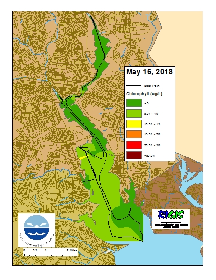
Data was collected on May 16, 2018 while the R/V Monitor was underway collecting bacteria samples and performing vertical profiles in the Providence and Seekonk River estuaries. The chlorophyll concentrations were good to fair in areas surveyed with evidence of a slight north-south gradient. From north to south, average chlorophyll concentrations were as follows: Seekonk River (3.58 µg/l), Upper Providence River (5.08 µg/l), Edgewood Shoals area (7.79 µg/l), Pawtuxet River area (5.19 µg/l), and the Lower Providence River (6.41 µg/l). Overall, chlorophyll ranged between non-detectable and 12.20 µg/l with an overall average of 5.28 µg/l. The chlorophyll data from this date is presented in the map below:
R/V Monitor's Blog
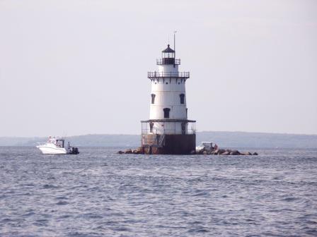
On Wednesday, May 16th, the crew of the R/V Monitor was out on the upper Bay collecting bacteria samples, taking Secchi Disk and Par sensor water clarity measurements, conducting water column profiles using the Seabird instrument, and conducting real-time surface mapping of water quality parameters, including dissolved oxygen, chlorophyll, water temperature, salinity, and pH, all in an effort to document water quality improvements associated with NBC construction projects. It was a partly cloudy day with a breeze out of the west, and a couple of brief showers occurred in the morning. The water was fairly calm this day, but mucky as a result of the rain the prior evening. The photo shown below was taken at the Conimicut Point Lighthouse, where a fisherman was enjoying the day.