Historical News
R/V Monitor's Blog
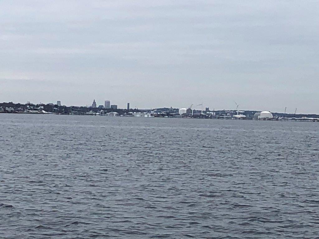
On Wednesday, December 4th, the crew of the R/V Monitor was out on the upper Bay collecting nutrients samples, taking Secchi Disk water clarity measurements, and conducting real-time surface mapping of water quality parameters, including dissolved oxygen, chlorophyll, water temperature, salinity, and pH, all in an effort to document water quality improvements associated with NBC construction projects. Sara captained the boat while monitoring professionals Mike and Fern collected the samples and data. It was a very cloudy day with no wind. A heavy fog in the early morning resulted in a delay getting underway. The photo featured this day shows Field's Point in the foreground with the City of Providence in the background.
Phytoplankton Sampling
Phytoplankton samples were collected on November 20, 2019 at Bullock's Reach and analyzed in the laboratory shortly after collection. It was a cloudy and raw day with a northwest wind, about 10 knots, on Narragansett Bay. Sondes data revealed the surface water temperature was 8.54oC, salinity was 27.38 psu, and chlorophyll a was 2.3 ug/L. The plankton tow net sample was filterable with a 20 micron mesh. The filtrate was a tan color and had a short filter time. The tow net sample was analyzed qualitatively for microorganisms using 100x phase contrast microscopy. The whole water sample was analyzed quantitatively under 200x phase contrast microscopy. A Hensen Stempel pipette was used to accurately deliver 1ml of sample to a Sedge-wick Rafter chamber. This analysis revealed a total of 408,000 cells per Liter. The most predominant phytoplankton was Leptocylindrus spp.at 196,000 cells/L. The flagellates were found at 52,000 cells/L. Representative genera include Skeletonema spp., Guinardia, and Chaetoceros spp.
200x phase contrast micrograph of Guinardia spp.
Nutrients Sampling
Nutrient samples were collected at seven river stations and one bay station (Phillipsdale Landing; surface and bottom) on October 23, 2019. On October 24, 2019, nutrient samples were collected at six bay stations (surface and bottom). On October 23, approximately half an inch of rainfall was recorded in the early morning hours.
Among the river stations sampled, highest total nitrogen (TN) was measured at Ten Mile River at Roger Williams Avenue, at 1030 ppb. Greatest total dissolved nitrogen (TDN), 998 ppb, occurred in a single sample at the Moshassuck River at Mill Street site, however, the average of duplicate samples at this site (938 ppb) was lower than the TDN concentration measured at Ten Mile River at Roger Williams Avenue (954 ppb). Dissolved inorganic nitrogen (DIN) was greatest (637 ppb) at the Pawtuxet River at Broad Street site. Lowest TN, TDN, and DIN values occurred at Moshassuck River at Higginson Avenue, with results of 504 ppb, 439 ppb, and 208 ppb, respectively.
Among the bay stations sampled, greatest TN (1000 ppb) and TDN (817 ppb) in surface waters occurred at Phillipsdale Landing, however, this location was sampled following some rainfall during the morning hours of October 23. Among the bay stations sampled the following day, highest TN and TDN results were observed at Pawtuxet Cove, at 940 ppb and 613 ppb, respectively. The greatest DIN concentration, 631 ppb, was also measured at Pawtuxet Cove. Lowest TN (564 ppb) was observed in one of two duplicate samples at Edgewood Yacht Club surface, however, the average of both duplicates at this site (594 ppb) was higher than results from Bullock Reach Buoy (572 ppb). Bullock Reach Buoy also had the lowest TDN value, at 233 ppb. Finally, lowest DIN occurred at Conimicut Point, at 194 ppb.
Results from sampling on November 6 and 20 are pending analysis. The next scheduled date of sampling is December 4, 2019.
Fixed Site Network
Phillipsdale Landing
Water quality was good this week at Phillipsdale Landing. Approximately 0.43 inches of precipitation was recorded over the week, with most of the rain occurring between November 18 and November 20. In response to the rainfall and increase in freshwater river flow, surface salinity decreased slightly mid-week. Surface salinity averaged 14.4 ppt and ranged from 5.9 ppt to 22.8 ppt. A portion of this week's bottom salinity data, approximately three hours in the afternoon on November 20, were deemed suspect by NBC scientists. The salinity data appeared anomalously low, indicating that perhaps the sensor was obstructed by debris. The remaining bottom salinity averaged 25.6 ppt and ranged from 12.5 ppt to 29.4 ppt. Compared to last week, water temperatures at both the surface and bottom cooled this week, with surface temperatures averaging 7.1°C and bottom temperatures averaging 9.2°C. Dissolved oxygen (DO) concentrations this week were good, remaining above the hypoxia threshold (2.9 mg/L) at both depths. Surface DO averaged 10.1 mg/L with a minimum of 8.5 mg/L and bottom DO averaged 8.1 mg/L with a minimum of 7.0 mg/L. Surface chlorophyll-a remained low all week, averaging 2.2 ug/L with a maximum of 8.4 ug/L. Note that tidal fluctuations and Blackstone River flow greatly influence water column DO, temperature, and salinity at this location.
Bullock Reach
Due to remote data transfer issues, there are no current Bullock Reach data available for this week. The data are being internally logged by the sondes, and will be updated to the blog as they become available.
Please note, the Bullock Reach sondes were removed for the 2019 season on November 19.
R/V Monitor's Blog
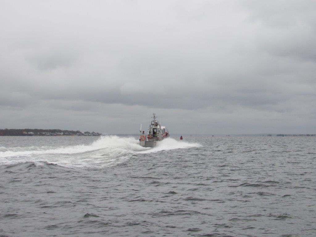
On Wednesday, November 20th, the crew of the R/V Monitor was out on the upper Bay collecting nutrients and plankton samples, taking Secchi Disk water clarity measurements, and conducting real-time surface mapping of water quality parameters, including dissolved oxygen, chlorophyll, water temperature, salinity, and pH, all in an effort to document water quality improvements associated with NBC construction projects. Jeff captained the boat while monitoring professionals Sara and Fern collected the samples and data. It was a cloudy, raw and wet day with a moderate wind blowing out of the north-northwest, making the water choppy. Today's photo features a rescue boat observed underway.