Week of April 11 - 17, 2021
R/V Monitor's Blog
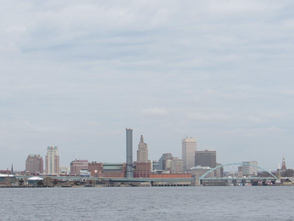
On Wednesday, April 14th, the crew of the R/V Monitor was out on the upper Bay collecting bacteria samples, taking Secchi Disk water clarity measurements, and conducting real-time surface mapping of water quality parameters, including dissolved oxygen, chlorophyll, water temperature, salinity, and pH, all in an effort to document water quality improvements associated with NBC construction projects. Jeff captained the boat while monitoring professionals Sara and Bekki collected the samples and data. It was a cloudy and brisk day. There was no wind to start off, but a south-southwest wind picked up later in the morning. Despite the wind, the water remained relatively calm. The photo shows the City of Providence from the south.
Week of April 11 - April 17, 2021
Surface Mapping
Data
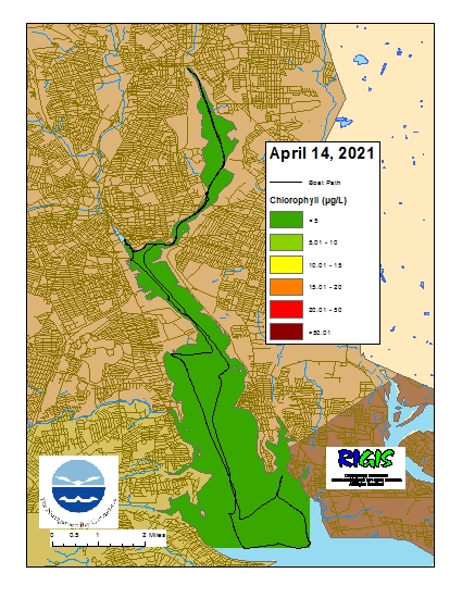
were collected on April 14, 2021 while the R/V Monitor was underway collecting bacteria
samples in the Seekonk and Providence River estuaries. The chlorophyll
concentrations were good in the areas surveyed. From north to south, average
chlorophyll concentrations were as follows: Seekonk
River (1.41 µg/L), Upper Providence River (0.97 µg/L),
Edgewood Shoals area (1.29 µg/L), Pawtuxet River area (2.37 µg/L), and Lower
Providence River (2.15 µg/L). Overall, chlorophyll ranged between 0.29 µg/L and
4.39 µg/L with an overall average of 1.52 µg/L. The chlorophyll data from this
date are presented in the map below:
Week of January 24 - 30, 2021
Nutrients Sampling
Nutrient samples were collected at six local river stations on January 27, 2021; a seventh site was planned but access was deemed unsafe due to snow. Over 4 inches of snowfall was recorded on the sampling day and day prior. The adverse weather conditions also led to the cancellation of planned boat sampling of the Bay sites.
Total nitrogen (TN), total dissolved nitrogen (TDN), and dissolved inorganic nitrogen (DIN) concentrations were highest at the Ten Mile River at Roger Williams Ave. site, measuring 2,400 ppb, 2,490 ppb, and 2,002 ppb, respectively. Nitrogen concentrations were lowest at the Moshassuck River at Higginson Ave. site, measuring 750 ppb (TN), 789 ppb (TDN), and 592 ppb (DIN).
Results from nutrients sampling on February 10 are pending analysis. The next scheduled sampling date is February 24.
Week of January 10 - 16, 2021
Nutrients Sampling
Nutrient samples were collected at fourteen local and border river stations and eight Bay stations on January 13, 2021; the bay stations were sampled at the surface and bottom. The weather leading up to the sampling day was dry, with no precipitation or snow melt recorded over the five days prior.
Among the river stations sampled, total nitrogen (TN), total dissolved nitrogen (TDN), and dissolved inorganic nitrogen (DIN) concentrations were highest at the Ten Mile River at Central Ave. site, measuring 3,040 ppb, 3,030 ppb, and 2,773 ppb, respectively. Nitrogen concentrations were lowest at the Palmer River at Rt. 6 site, measuring 706 ppb (TN), 456 ppb (TDN), and 215 ppb (DIN). One of the duplicate samples collected from the Moshassuck River at Higginson Ave. site had slightly lower TN (704 ppb), though the other duplicate was higher (718 ppb).
Among the Bay stations sampled, the highest surface nitrogen concentrations were observed at Pawtuxet Cove. At this site, TN, TDN, and DIN concentrations were 1,570 ppb, 1,470 ppb, and 1,281 ppb, respectively. The lowest surface TN and DIN concentrations were observed at Pomham Rocks, at 779 ppb and 495 ppb, respectively. TDN at this site measured 648 ppb. Surface TDN was lowest (639 ppb) at Conimicut Point. Chlorophyll-a concentrations at the Bay sites remain low, averaging just 1.42 ug/L. The maximum result of 2.83 ug/L was recorded at Phillipsdale Landing (average of duplicates).
Results from nutrients sampling on January 27 are pending analysis. The next scheduled sampling date is February 10.
Week of April 4 - 10, 2021
R/V Monitor's Blog
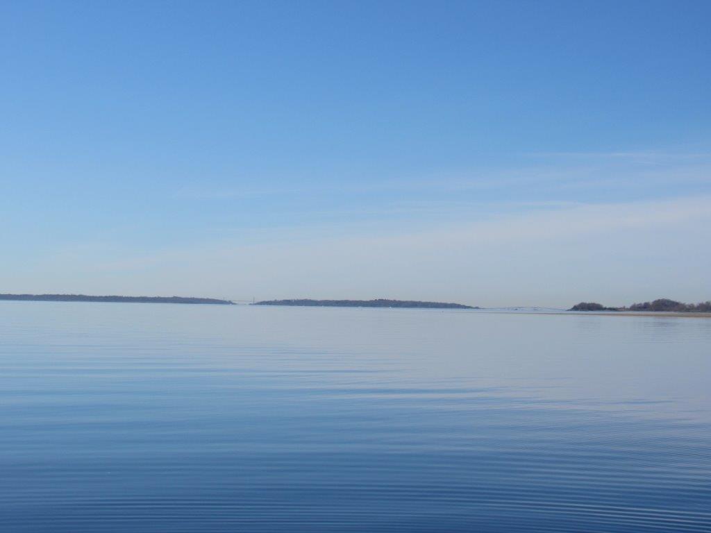
On Wednesday, April 7th, the crew of the R/V Monitor was out on the upper Bay collecting nutrients and plankton samples, taking Secchi Disk and Par sensor water clarity measurements, conducting water column profiles using the Seabird instrument, and conducting real-time surface mapping of water quality parameters, including dissolved oxygen, chlorophyll, water temperature, salinity, and pH, all in an effort to document water quality improvements associated with NBC construction projects. Sara captained the boat while monitoring professionals Mike and Fern collected the samples and data. It was a beautiful cool and sunny day with no wind and calm waters in the morning. The wind picked-up as the as the morning progressed and a slight chop on the water developed. The featured photo was taken from Conimicut Point looking southward. The Newport and Jamestown bridges can be seen in the far background.