Week of October 16-22, 2022
Water Column Profiles
Water column profiles were conducted at seven locations in the Providence and Seekonk River estuaries using a Seabird instrument on October 19th, 2022. In the three days leading up to the sampling event, 0.35 inches of rainfall was recorded at T.F. Green. Evidence of moderate density stratification was observed at most sites this week, with Conimicut Point, India Point Park, and Phillipsdale Landing showing signs of being strongly stratified.
Surface salinities among all sites ranged from 26.6 psu at Bullock Reach Buoy down to 3.5 psu at Phillipsdale Landing. Bottom salinities ranged from 30.9 psu at Conimicut Point West down to 24.4 psu at Phillipsdale Landing. The warmest surface water temperature (17.1°C) was observed at Bullock Reach Buoy, while the warmest bottom temperature (17.1°C) was observed at Pawtuxet Cove. The coolest water temperatures ranged from 16.7°C at the bottom of India Point Park to 14.4°C at surface of Phillipsdale Landing.
Dissolved oxygen (DO) conditions remained above the hypoxia threshold (2.9 mg/L) at all sites this week; the lowest DO observed was approximately 3.3 mg/L in the bottom waters at Phillipsdale Landing. Overall, fluorescence was similar to the previous survey, with the highest values (3.099 mg/m3) observed at the surface (<1.75 m) at Conimicut Point West. Please note numerical fluorescence data were not posted from 2020 to 2021 due to a QC issue. This issue has been resolved and fluorescence data from 2020 and 2021 will be backfilled.
Week of October 9-15, 2022
Water Column Profiles
Water column profiles were conducted at five locations in the Providence and Seekonk River estuaries using a Seabird instrument on Oct. 12th, 2022. In the three days leading up to the sampling event, 0.00 inches of rainfall was recorded at T.F. Green. Evidence of weak density stratification was observed at all sites this week.
Surface salinities among all sites ranged from 29.4 psu at Conimicut Point West down to 25.1 psu at Point St. Bridge and Phillipsdale Landing. Bottom salinities ranged from 31.0 psu at Conimicut Point down to 27.6 psu at Point St. Bridge and Phillipsdale Landing. The warmest surface and bottom water temperature (19.7°C) was observed at Point St. Bridge. The coolest water temperatures at the surface and bottom were both at Bullock Reach Buoy, with 15.9°C at the surface and 16.3°C at bottom.
Dissolved oxygen (DO) conditions remained above the hypoxia threshold (2.9 mg/L) at all sites this week; the lowest DO observed was approximately 6.75 mg/L in the bottom waters at India Point Park. Overall, fluorescence decreased from the previous survey with the highest values (2.73 mg/m3) observed at ~2.00 m at Bullock Reach Buoy. Please note numerical fluorescence data were not posted from 2020 to 2021 due to a QC issue. This issue has been resolved and fluorescence data from 2020 and 2021 will be backfilled.
Week of January 15 - 21, 2023
R/V Monitor's Blog
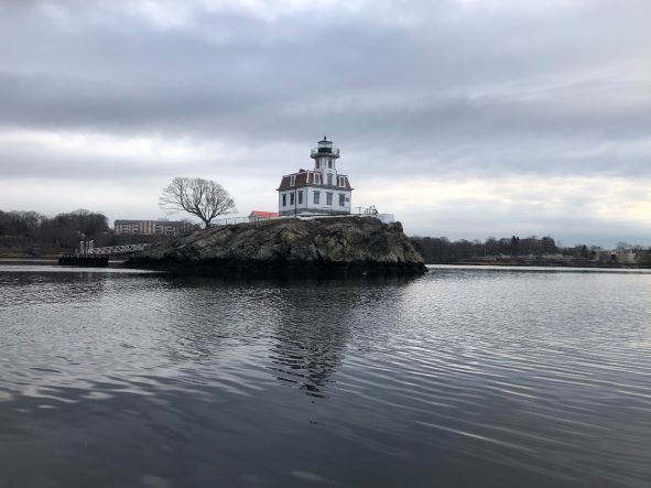
On Wednesday, January 18th, the crew of the R/V Monitor was out on the upper Bay collecting bacteria samples, taking Secchi Disk water clarity measurements, and conducting real-time surface mapping of water quality parameters, including dissolved oxygen, chlorophyll, water temperature, salinity, and pH, all in an effort to document water quality improvements associated with NBC construction projects. Jeff captained the boat while monitoring professionals Amanda and Daryll collected the samples and data. It was mostly cloudy but relatively warm with calm waters. The featured photo taken was of the Pomham Rocks Lighthouse.
Week of January 15 - 21, 2023
Water Column Clarity
Water clarity was measured at six locations in the Providence River and Seekonk River estuaries on January 18. Rainfall totaling 0.52 inches was recorded at TF Green in the five days prior to the survey. Secchi depth averaged 2.7 meters, compared to 3.3 meters on the previous survey (January 10). The lowest clarity this week (2.6 meters) was measured at India Point Park, Phillipsdale Landing, and Pomham Rocks, while the greatest clarity (2.9 meters) was measured at Bullock Reach and Conimicut Point. There was a general north-to-south gradient of increasing water clarity among the sites this week.
Week of October 16-22, 2022
Nutrients Sampling
Nutrient samples were collected from seven bay stations and seven local river stations on October 19th. Most of the bay stations, except for Phillipsdale Landing, were sampled at the surface and bottom. In the five days prior to sampling, 1.10 inches of rainfall was recorded at T.F. Green.
Among the river stations sampled, the highest total nitrogen (TN), total dissolved nitrogen (TDN), and dissolved inorganic nitrogen (DIN) were observed at Pawtuxet River @ Broad St. The TN, TDN, and DIN at this site were 1,340 ppb, 1,200 ppb, and 922 ppb, respectively. The lowest TN, TDN, and DIN were observed at Moshassuck River at Higginson Ave. The TN, TDN, and DIN at this site were 488 ppb, 493 ppb, and 226.3 ppb, respectively.
Among the bay stations sampled, the highest surface nitrogen concentrations were observed at Pawtuxet Cove. The TN, TDN, and DIN at this site were 1,300 ppb, 1,180 ppb, and 908 ppb, respectively. The lowest surface nitrogen concentrations were observed at Bullock Reach Buoy. The TN, TDN, and DIN at this site were 759 ppb, 563 ppb, and 376 ppb, respectively. Chlorophyll a concentrations at the surface bay stations were low, averaging 1.52 ug/L across all sites. The maximum result (2.62 ug/L) occurred at Bullock Reach Buoy.
Results from nutrient sampling in November through December are pending analysis. The next scheduled sample date is January 25th.

