Historical News
R/V Monitor's Blog
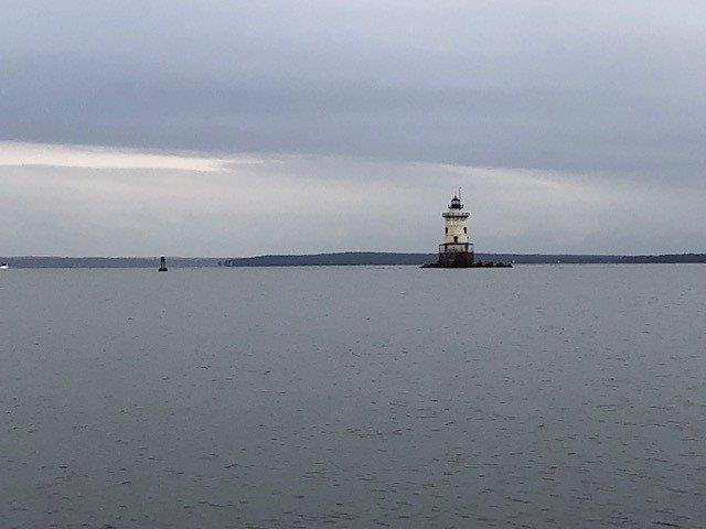
On Wednesday, December 2nd, the crew of the R/V Monitor was out on the upper Bay collecting nutrients samples, taking Secchi Disk and Par sensor water clarity measurements, conducting water column profiles using the Seabird instrument, and conducting real-time surface mapping of water quality parameters, including dissolved oxygen, chlorophyll, water temperature, salinity, and pH, all in an effort to document water quality improvements associated with NBC construction projects. Sara captained the boat while monitoring professionals Fern, Steve, Daryll and Jeff collected the samples and data. It was a chilly day with a mix of sun and clouds and a few sprinkles of rain. There was a slight breeze from the southwest and calm waters. The featured photo this day is of Conimicut lighthouse.
Surface Mapping
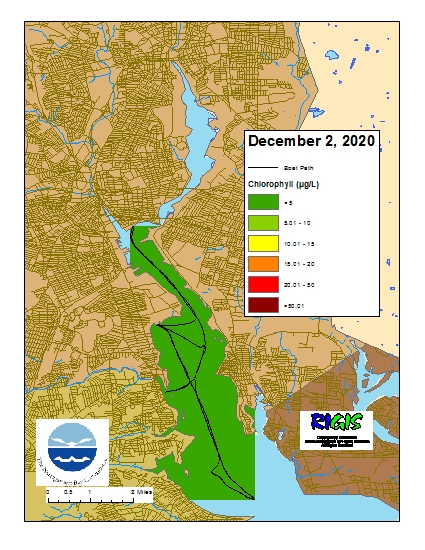
Data were collected on December 2, 2020 while the R/V Monitor was underway collecting nutrient samples and performing vertical profiles in the Providence River estuary. The chlorophyll concentrations were low in the areas surveyed. From north to south, average chlorophyll concentrations were as follows: Upper Providence River (3.24 µg/L), Edgewood Shoals area (2.94 µg/L), Pawtuxet River area (3.59 µg/L), and Lower Providence River area (2.19 µg/L). Overall, chlorophyll ranged between 0.30 µg/L and 5.50 µg/L with an overall average of 2.90 µg/L. The chlorophyll data from this date are presented in the map below:
R/V Monitor's Blog
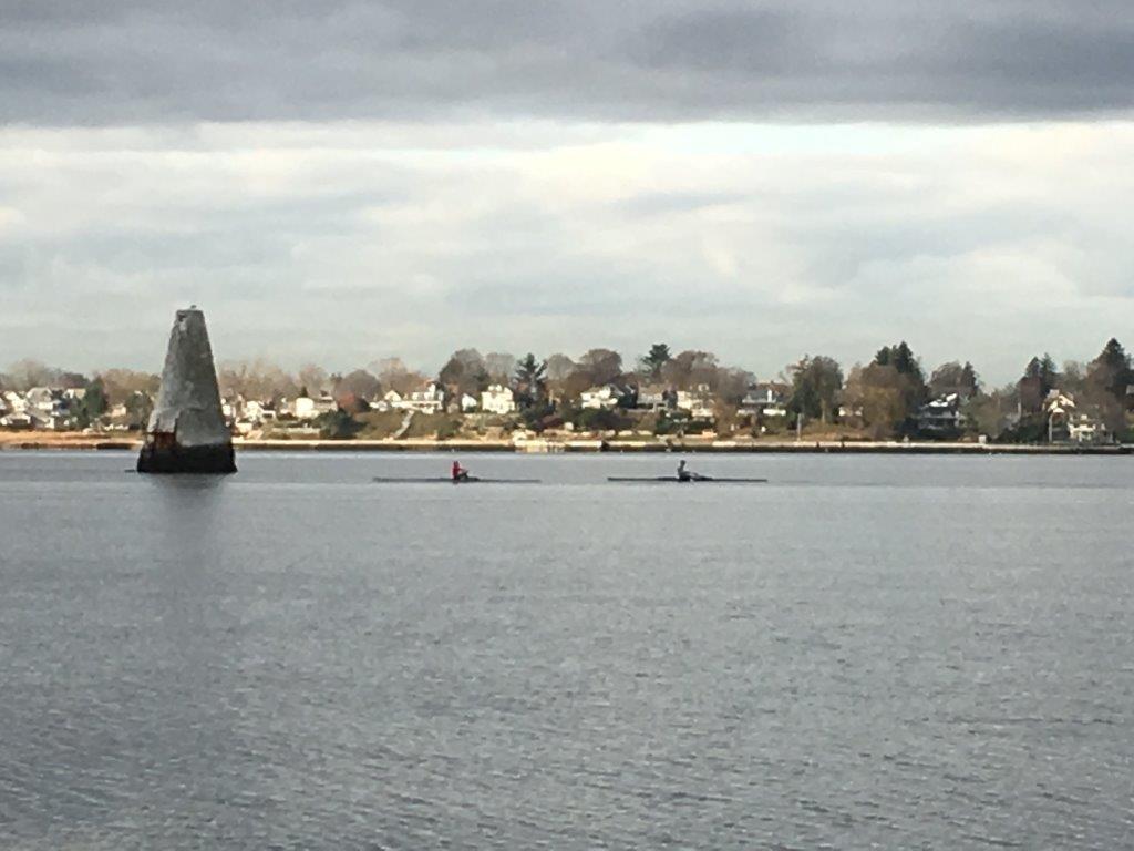
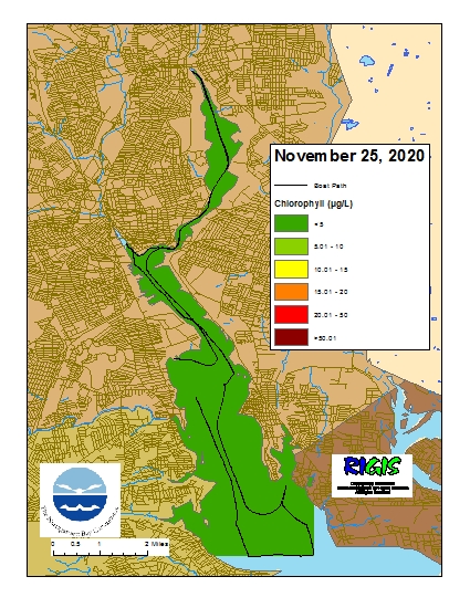
On Wednesday, November 25th, the crew of the R/V Monitor was out on the upper Bay collecting bacteria samples, taking Secchi Disk water clarity measurements, and conducting real-time surface mapping of water quality parameters, including dissolved oxygen, chlorophyll, water temperature, salinity, and pH, all in an effort to document water quality improvements associated with NBC construction projects. Jeff captained the boat while monitoring professionals Karen and Fern collected the samples and data. It was a cool and cloudy day with no wind and dead calm waters. The featured photo of some rowers was taken in the Seekonk River near India Point.
Surface Mapping
Data
were collected on November 25, 2020 while the R/V Monitor was underway
collecting bacteria samples in the Seekonk and
Providence River estuaries. The chlorophyll concentrations were good in the
areas surveyed. From north to south, average chlorophyll concentrations were as
follows: Seekonk River (2.66 µg/L), Upper Providence River (2.00 µg/L),
Edgewood Shoals area (2.04 µg/L), Pawtuxet River area (1.93 µg/L), and Lower
Providence River area (2.14 µg/L). Overall, chlorophyll ranged between 0.10
µg/L and 4.90 µg/L with an overall average of 2.27 µg/L. The chlorophyll data
from this date are presented in the map below:
R/V Monitor's Blog
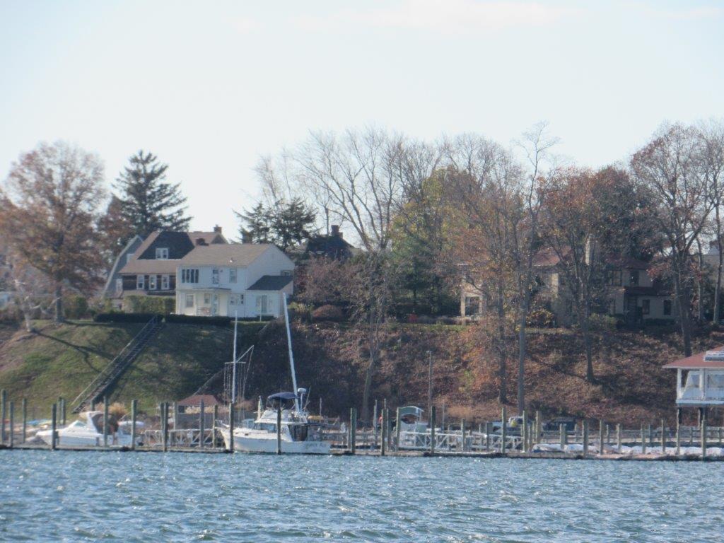
The crew of the R/V Monitor was out on the upper Bay twice this week. First, on Tuesday, November 17th, the crew dismantled the components from the Bullock's Reach buoy for the season, readying the buoy for removal next week. They also disassembled and removed the temporary buoy located in Pawtuxet Cove for the season. Jeff captained the boat while monitoring professionals Sara, Mike and Daryll worked on the buoys. It was a sunny but brisk day with calm winds and water. On Wednesday, November 18th, the crew returned to the upper Bay collecting nutrients samples, taking Secchi Disk and Par sensor water clarity measurements, conducting waterr column profiles using the Seabird instrument, and conducting real-time surface mapping of water quality parameters, including dissolved oxygen, chlorophyll, water temperature, salinity, and pH, all in an effort to document water quality improvements associated with NBC construction projects. Jeff captained the boat while monitoring professionals Bekki and Mike collected the samples and data. It was a sunny but cold day with 10 to 15 knot winds from the north-northwest. There were 3 foot swells at the Bullock's Reach and Conimicut sampling locations preventing nutrients sample collections. The water was calmer at the northern stations and samples were able to be collected. The featured photo was taken at Pawtuxet Cove.