Week of October 2-8, 2022
Nutrients Sampling
Nutrient samples were collected from thirteen local and border river stations and one bay station (Phillipsdale Landing) on October 5th. Phillipsdale Landing was sampled at the surface and bottom. In the five days prior to sampling, 1.38 inches of rainfall was recorded at T.F. Green.
Among the river stations sampled, the highest total nitrogen (TN), total dissolved nitrogen (TDN), and dissolved inorganic nitrogen (DIN) were observed at Blackstone River at Bikepath Bridge. Results at this site (average of duplicates) for TN, TDN, and DIN were 2,140 ppb, 2,280 ppb, and 1,920 ppb, respectively. The lowest TN and TDN were observed at Runnins River at River Road. The TN and TDN were 530 ppb and 517 ppb, respectively. The lowest DIN, observed at Coles River at Milford Rd., was 31.6 ppb.
The Phillipsdale Landing bay sample had TN, TDN, and DIN surface results of 1,200 ppb, 1,220 ppb, and 849 ppb, respectively. Chlorophyll a concentration at Phillipsdale Landing decreased from 53.60 ug/L to 2.71 ug/L since the previous sampling event.
Results from nutrient sampling in late October through December are pending analysis. The next scheduled sample date is January 25th.
Week of January 8 - 14, 2023
Water Column Clarity
Water clarity was measured at six locations in the Providence River estuary on January 10. Rainfall totaling 0.18 inches was recorded at TF Green in the five days prior to the survey. Secchi depth averaged 3.3 meters, compared to 4.2 meters on the previous survey (November 29, 2022). The lowest clarity this week (2.6 meters) was measured at India Point Park, while the greatest clarity (4.2 meters) was measured at Conimicut Point. There was a general north-to-south gradient of increasing water clarity among the sites this week.
Week of January 8 - 14, 2023
R/V Monitor's Blog
On Tuesday, January 10th, the crew of the R/V Monitor
was out on the upper Bay for the first time this year collecting nutrients and plankton samples, taking
Secchi Disk water clarity measurements, and conducting real-time surface mapping
of water quality parameters, including dissolved oxygen, chlorophyll, water
temperature, salinity, and pH, all in an effort to document water quality
improvements associated with NBC construction projects. Jeffrey captained the boat
while monitoring professionals Jeff, and Tyler collected the samples and
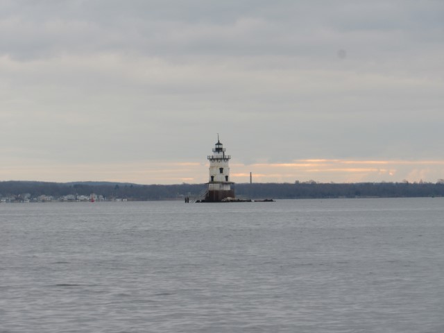
data. It was a cloudy and cool day with a calm wind out of the northwest. The water was calm all day. The featured photo shows the Conimicut Point lighthouse.
Week of November 27 - December 3, 2022
Water Column Clarity
Water clarity was measured at six locations in the Providence River estuary on November 29. Rainfall totaling 0.54 inches was recorded at TF Green in the five days prior to the survey, the majority of which fell on November 27. Secchi depth averaged 4.2 meters, compared to 3.1 meters on the previous survey (November 23). The lowest clarity this week (3.77 meters) was measured at Pawtuxet Cove, while the greatest clarity (4.5 meters) was measured at India Point Park. There was a general north-to-south gradient of decreasing water clarity among the sites this week.
Week of September 25-October 1, 2022
Water Column Profiles
Water column profiles were conducted at eight locations in the Providence and Seekonk Rivers using a Seabird instrument on September 28, 2022. In the three days leading up to the sampling event, 0.30 inches of rainfall was recorded at T.F. Green. Evidence of density stratification was observed at most sites this week, with Point Street Bridge and Phillipsdale Landing showing signs of being strongly stratified.
Surface salinities among all sites ranged from 28 psu at Bullock Reach Buoy and Conimicut Point West down to 16 psu at Phillipsdale Landing. Bottom salinities ranged from 30 psu at Conimicut Point down to 25 psu at Phillipsdale Landing. The warmest surface water temperature (22°C) was observed at Point St. Bridge, while the warmest bottom temperature (20°C) was observed at most of the sites. The coolest water temperatures ranged from 18°C at the surface of Bullock Reach Buoy to 19.0°C at bottom of Conimicut Point.
Dissolved oxygen (DO) conditions remained above the hypoxia threshold (2.9 mg/L) at all sites this week; the lowest DO observed was approximately 4.1 mg/L in the bottom waters at Point St. Bridge. Overall, fluorescence decreased from the previous week, with the highest values (4.23 mg/m3) observed at the surface (<1.00 m) at Edgewood Yacht Club. Please note numerical fluorescence data were not posted from 2020 to 2021 due to a QC issue. This issue has been resolved and fluorescence data from 2020 and 2021 will be backfilled.

