Historical News
Week of September 25-October 1, 2022
Water Column Profiles
Water column profiles were conducted at eight locations in the Providence and Seekonk Rivers using a Seabird instrument on September 28, 2022. In the three days leading up to the sampling event, 0.30 inches of rainfall was recorded at T.F. Green. Evidence of density stratification was observed at most sites this week, with Point Street Bridge and Phillipsdale Landing showing signs of being strongly stratified.
Surface salinities among all sites ranged from 28 psu at Bullock Reach Buoy and Conimicut Point West down to 16 psu at Phillipsdale Landing. Bottom salinities ranged from 30 psu at Conimicut Point down to 25 psu at Phillipsdale Landing. The warmest surface water temperature (22°C) was observed at Point St. Bridge, while the warmest bottom temperature (20°C) was observed at most of the sites. The coolest water temperatures ranged from 18°C at the surface of Bullock Reach Buoy to 19.0°C at bottom of Conimicut Point.
Dissolved oxygen (DO) conditions remained above the hypoxia threshold (2.9 mg/L) at all sites this week; the lowest DO observed was approximately 4.1 mg/L in the bottom waters at Point St. Bridge. Overall, fluorescence decreased from the previous week, with the highest values (4.23 mg/m3) observed at the surface (<1.00 m) at Edgewood Yacht Club. Please note numerical fluorescence data were not posted from 2020 to 2021 due to a QC issue. This issue has been resolved and fluorescence data from 2020 and 2021 will be backfilled.
Week of September 18-24, 2022
Water Column Profiles
Water column profiles were conducted at eight locations in the Providence and Seekonk Rivers using a Seabird instrument on September 21, 2022. In the three days leading up to the sampling event, 0.08 inches of rainfall was recorded at T.F. Green. Evidence of density stratification was observed at most sites, while the water column at Pomham Rocks, Edgewood Yacht Club, and Edgewood Shoal was more well-mixed.
Surface salinities among all sites ranged from 29 psu at Pomham Rocks down to 16 psu at Phillipsdale Landing. Bottom salinities ranged from 31.5 psu at Conimicut Point down to 27.5 psu at Phillipsdale. The warmest surface water temperature (22.4°C) was observed at India Point Park, while the warmest bottom temperature (22.2°C) was observed at Pawtuxet Cove and Phillipsdale Landing. The coolest water temperatures ranged from 21.4°C at the surface of Conimicut Point West and Phillipsdale Landing to 21.1°C at bottom of Conimicut Point.
Dissolved oxygen (DO) conditions remained above the hypoxia threshold (2.9 mg/L) at most sites except for three sites dropping into hypoxic conditions in the middle to bottom waters: Edgewood Yacht Club (minimum of 2.54 mg/L), Edgewood Shoal (minimum of 1.64 mg/L), and Phillipsdale Landing (minimum 2.09 mg/L). Overall, fluorescence increased from the previous week, with the highest values (39.97 mg/m3) observed near the surface (~1.25 m) at Phillipsdale Landing. Please note numerical fluorescence data were not posted from 2020 to 2021 due to a QC issue. This issue has been resolved and fluorescence data from 2020 and 2021 will be backfilled.
Week of September 11-17, 2022
Water Column Profiles
Water column profiles were conducted at eight locations in the Providence and Seekonk Rivers using a Seabird instrument on September 14, 2022. In the three days leading up to the sampling event, 0.68 inches of rainfall was recorded at T.F. Green. Evidence of moderate to weak density stratification was observed at all of the sites this week.
Surface salinities among all sites ranged from 28 psu at Bullock Reach Buoy and Conimicut Point down to 20 psu at Phillipsdale Landing. Bottom salinities ranged from 31 psu at Conimicut Point down to 25 psu at Phillipsdale Landing. Point St. Bridge had the warmest surface and bottom temperatures, 24.6°C and 23.9°C respectively. The coolest water temperatures ranged from 22.4°C at the surface of Bullock Reach Buoy and Conimicut Point West to 22.2°C at bottom of Conimicut Point.
Dissolved oxygen (DO) conditions remained above the hypoxia threshold (2.9 mg/L) at most sites except for three sites dropping below the limit in the middle to bottom waters, with Phillipsdale Landing with a minimum of 2.41 mg/L, and India Point Park with a minimum of 2.98 mg/L. The third site with hypoxic conditions has low DO in the bin-averaged data at the bottom of Pomham Rocks, which is believed to be an artifact of the bin-averaging data calculations or due to sediment interference. Overall, fluorescence increased slightly from the previous week, with the highest values (4.70 mg/m3) observed near the surface (~1.00 m) at Pawtuxet Cove. Please note numerical fluorescence data were not posted from 2020 to 2021 due to a QC issue. This issue has been resolved and fluorescence data from 2020 and 2021 will be backfilled.
Week of October 23 - 29, 2022
Fixed Site Network
Phillipsdale Landing
Overall, water quality at Phillipsdale Landing was fair to good this week. Weather conditions were moderately wet, with 1.99 inches of rainfall recorded at T.F. Green. The Blackstone River flow remained slightly above the 17-year daily median for the majority of the week. The rainfall throughout the start of the week maintained the stratified conditions that set up earlier this month. Surface salinity remained well below bottom salinity. Salinity at the surface averaged 15.1 ppt and ranged from 4.7 ppt to 24.4 ppt. At the bottom, salinity averaged 24.8 ppt and ranged from 11.3 ppt to 29.0 ppt. Temperatures this week averaged 15.4°C at the surface and 16.3°C at the bottom. Surface temperatures ranged from 12.3°C to 17.4°C, while bottom temperatures ranged from 14.7°C to 17.3°C.
Dissolved oxygen (DO) at Phillipsdale Landing has remained high at the surface, staying above the hypoxia threshold (i.e., DO >2.9 mg/L) throughout the week. Surface DO did decline slightly compared to the previous week, averaging 6.9 mg/L and ranging 4.5 – 9.1 mg/L. Bottom DO concentrations also remained above the hypoxia level all week. Bottom water DO concentration averaged 4.9 mg/L and ranged from 3.2 mg/L to 7.4 mg/L, generally increasing over the course of the week. Chlorophyll remained low, averaging 1.6 ug/L at the surface and 3.4 ug/L at the bottom. Maximum surface chlorophyll readings reached 7.8 ug/L, recorded in the afternoon of October 28th. Please note that tidal fluctuations and Blackstone River flows greatly influence water column salinity, temperature, and DO at this location.
Bullock Reach
Sondes were swapped for routine maintenance on the morning of October 25th. Overall, water quality was good at Bullock Reach this week. Salinity averaged 26.3 ppt, 28.9 ppt, and 30.3 ppt at the surface, middle, and bottom sondes, respectively. Surface salinity ranged 20.6-29.7 ppt, mid salinity ranged 25.1-31.1 ppt, and bottom salinity ranged 28.0-31.2 ppt. Temperatures have dropped slightly compared to the previous week. Surface temperature averaged 15.9°C and ranged from 13.9°C to 17.7°C. Mid temperatures averaged 16.1°C and ranged from 14.9°C to 17.1°C. Bottom temperatures averaged 16.2°C and ranged from 15.6°C to 16.8°C.
DO concentrations at Bullock Reach remained above the hypoxia threshold all week. Surface DO averaged 7.0 mg/L and ranged 5.8 – 9.2 mg/L. In the mid waters, DO averaged 6.7 mg/L and ranged 5.8 – 8.3 mg/L. At the bottom, DO averaged 6.4 mg/L and ranged 5.3– 7.1 mg/L. A decline in the surface and middle DO at the start of the week preceded a gradual increase of DO, ending slightly lower than the start of the week. Bottom DO did not see the initial drop but did follow the slight increasing trend of the surface and middle DO. Chlorophyll concentrations were low all week. Overall, chlorophyll averaged 3.1 ug/L, 3.3 ug/L, and 1.6 ug/L at the surface, mid, and bottom waters, respectively. The maximum surface chlorophyll was early in the week, reading 13.9 ug/L on October 23rd.
Week of November 27 - December 3, 2022
R/V Monitor's Blog
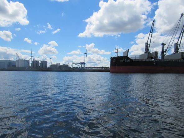
On Wednesday, November 30th, the crew of the R/V Monitor was out on the upper Bay collecting nutrients samples, taking Secchi Disk water clarity measurements, conducting water column profiles using a profiling sonde, and conducting real-time surface mapping of water quality parameters, including dissolved oxygen, chlorophyll, water temperature, salinity, and pH, all in an effort to document water quality improvements associated with NBC construction projects. Jeffrey captained the boat while monitoring professionals Fern, Gerard and Steve collected the samples and data. It was a sunny and brisk day with no wind and calm waters. The featured photo from our archives shows ProvPort from the east.