Historical News
R/V Monitor's Blog
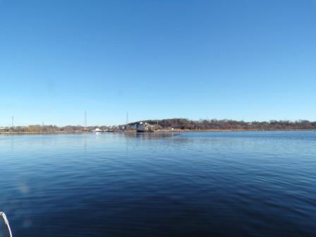
On Wednesday, January 9th, the crew of the R/V Monitor was out on the upper Bay collecting bacteria samples, taking Secchi Disk and Par sensor water clarity measurements, conducting water column profiles using the Seabird instrument, and conducting real-time surface mapping of water quality parameters, including dissolved oxygen, chlorophyll, water temperature, salinity and pH, all in an effort to document water quality improvements associated with NBC construction projects. Jeff captained the boat, while monitoring professionals Mike and Fern collected the samples and data. The day started sunny any calm, but winds picked up by late morning. The water remained calm throughout the sampling day. The photo below was taken back in December on the Seekonk River.
Water Column Profiles
Highest water column salinity was measured at Conimicut Point, where salinity ranged from approximately 18 psu at the surface to 29.3 psu at depth. Lowest salinity was recorded at Pawtuxet Cove, with readings of 3.5 psu in surface waters and 19.9 psu at depth. Surface water temperature was coldest at Pomham Rocks, at 4.3°C, while the greatest surface water temperature, 5.7°C, occurred at Edgewood Yacht Club. Bottom water temperatures ranged from 6.4°C at Pawtuxet Cove to 7.0°C at Conimicut Point.
Hypoxic conditions (dissolved oxygen <2.9 mg/L) were not present at any of the sites sampled. Dissolved oxygen ranged from 9.06 mg/L at depth at Pawtuxet Cove to 12.29 mg/L in surface waters of Pomham Rocks. Fluorescence averaged 1.3 mg/m3 at all sites, and the maximum fluorescence (2.4 mg/m3) was observed at Bullock Reach.
Surface Mapping
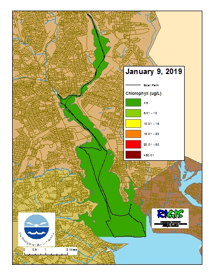
Data was collected on January 9, 2019 while the R/V Monitor was underway collecting bacteria samples. The chlorophyll concentrations were low in areas surveyed. From north to south, average chlorophyll concentrations were as follows: Seekonk River (3.04 µg/l), Upper Providence River (3.12 µg/l), Edgewood Shoals area (3.49 µg/l), Pawtuxet River area (3.00 µg/l), and the Lower Providence River (2.61 µg/l). Overall, chlorophyll ranged between 1.40 µg/l and 5.30 µg/l with an overall average of 3.00 µg/l. The chlorophyll data from this date is presented in the map below:
Phytoplankton Sampling
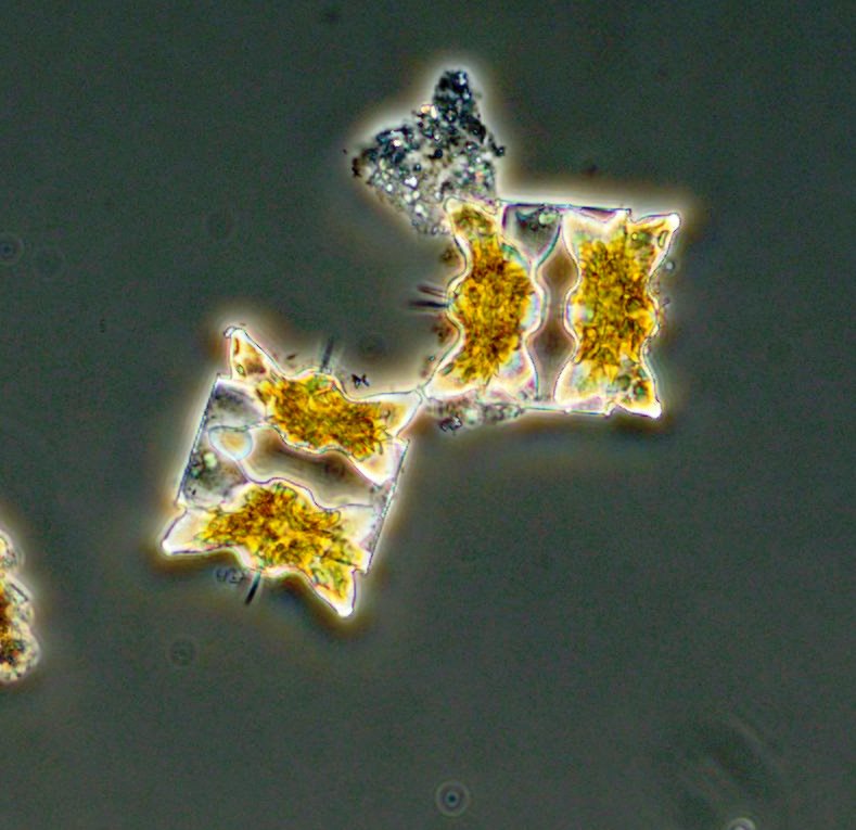
Phytoplankton samples were collected at Bullock's Reach on January 3, 2019 and analyzed in the laboratory shortly after collection. It was a cold and rainy day on Narragansett Bay. Sondes data revealed the surface water temperature was 4.46oC, salinity was 14.18 psu, and chlorophyll a was 3.1 ug/L. The plankton tow net sample was filterable with a 20 micron mesh. The filtrate was light golden brown with noticeable particulate matter and a medium filter time. The tow net sample was analyzed qualitatively for microorganisms using 100x phase contrast microscopy. The whole water sample was analyzed quantitatively under 200x phase contrast microscopy. A Hensen Stempel pipette was used to accurately deliver 1ml of sample to a Sedge-wick Rafter chamber. This analysis revealed a total of 193,000 cells per Liter. The most predominant phytoplankton was Skeletonema at 154,000 cells/L. The flagellates were found at 5,000 cells/L and other representative genera include Leptocylindrus spp. and Thalassionema spp.
200x phase contrast micrograph of Odontella spp.
Water Column Profiles
