Historical News
R/V Monitor's Blog
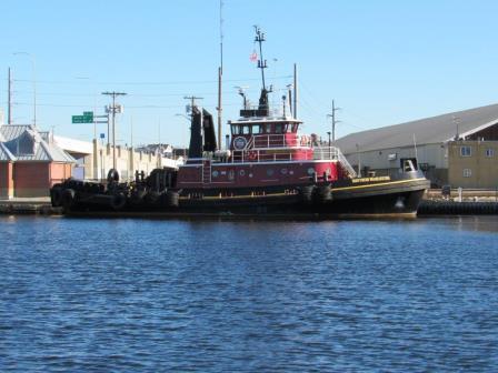
After several weeks of inclement weather, the R/V Monitor was out on the upper Bay twice this week. First, on Tuesday, February 5th, the crew was out conducting underwater benthic video transects, to document how reduced nitrogen loadings to the upper Bay impacts the local benthos. Three transects, using an underwater video camera mounted on a sled, were conducted this day. Jeff captained the boat, while monitoring professionals Gerard, Bekki, and Amanda worked the video equipment. It was a partly sunny day, warm and little wind. The waters were calm, ideal conditions to conduct the transect monitoring. Again, on Wednesday, February 6th, the crew was out collecting bacteria samples, taking Secchi Disk and Par sensor water clarity measurements, conducting water column profiles using the Seabird instrument, and conducting real-time surface mapping of water quality parameters, including dissolved oxygen, chlorophyll, water temperature, salinity and pH, all in an effort to document water quality improvements associated with NBC construction projects. Jeff captained the boat while monitoring professionals Amanda and Gerard collected the samples and data. It was a sunny but brisk day, and the wind and water were calm. Below is a photo taken on February 6th of a tug boat in the upper Bay.
Bacteria Sampling
Water Column Clarity
Water clarity was measured by Secchi disk at six locations on January 9, 2019. Very light rainfall of approximately 0.13 inches was recorded in the three days prior to the survey, and clarity overall was very similar to the previous week. The highest water clarity, 3.50 m, was measured at Edgewood Yacht Club; the lowest clarity, 1.70 m, was measured at Point St. Bridge. Overall clarity averaged 2.74 m across sites, compared to 2.56 m last week, with approximately half of sites exhibiting an increase and half exhibiting a decrease since the previous survey. There was a weak gradient in increasing clarity with distance down bay.
Water Column Clarity
Water clarity was measured by Secchi disk at seven locations on January 3, 2019. Approximately 1 inch of rainfall was recorded in the three days prior to the survey. Water clarity was lower on average than the previous survey, averaging 2.56 meters versus 2.79 m two weeks ago. Clarity at individual sites was variable, with about half of the sites exhibiting increased clarity and half decreasing. The lowest clarity overall was 1.83 m at Pomham Rocks. The highest was 3.63 m at Bullock Reach. There was a weak gradient in increasing clarity with distance down bay.
Nutrients Sampling
Fourteen local and border river stations and one bay station (surface and bottom) were sampled for nutrients on December 5, 2018. Due to inclement weather, the boat did not go out to collect bay samples, but Phillipsdale Landing was collected by land. In the five days before sampling, there was 0.69 in of recorded rainfall.
Among the river stations sampled, highest total nitrogen (TN), total dissolved nitrogen (TDN), and dissolved inorganic nitrogen (DIN) values were measured in the Ten Mile River at Central Ave, with reported values of 1,480 ppb, 1,660 ppb, and 1,401 ppb, respectively. The Coles River had the lowest measured TN (569 ppb) and DIN, TDN (253 ppb) values with the Palmer River having the lowest TDN value with 638 ppb.
The only bay sample at Phillipsdale Landing had surface TN, TDN and DIN values of 1,100 ppb, 1,280 ppb, and 928 ppb respectively. The bottom sample had concentrations of 1,080 pbb for TN, 1,130 for TDN, and a DIN of 909 ppb.
Results from nutrient sampling completed on December 19, January 2, 2019 and January 16 are pending final analysis from the NBC Laboratory. The next anticipated date of sampling is January 30, 2019.
