Historical News
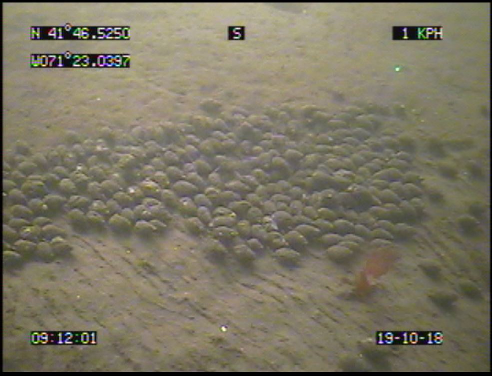
Benthic Video Blog
Water Column Clarity
Water clarity was measured at five locations in the Providence and Seekonk Rivers on December 19, 2018. In the five days prior to sampling, 0.91 inches of rainfall occurred. Average water clarity increased from the previous sampling, from 1.6 m to 2.8 m.
Water clarity increased at all five sites sampled: India Point, Pomham Rocks, Edgewood Yacht Club, Pawtuxet Cove, and Conimicut Point. The largest increase in clarity, 2.2 m, occurred at India Point. Secchi depth ranged from 1.83 m at Pawtuxet Cove to 3.63 m at India Point. There was evidence of a slight north to south water clarity gradient.
Water Column Profiles
Phytoplankton Sampling
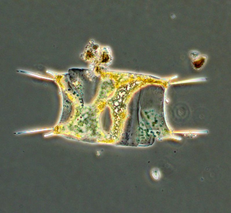
Phytoplankton samples were collected at Bullock's Reach on November 21, 2018 and analyzed in the laboratory shortly after collection. It was a cold day on Narragansett Bay. Sondes data revealed the surface water temperature was 9.11oC, salinity was 22.55 psu, and chlorophyll a was 0.6 ug/L. The plankton tow net sample was filterable with a 20 micron mesh. The filtrate was thick and opaque with a light rusty brown color and a long filter time. The tow net sample was analyzed qualitatively for microorganisms using 100x phase contrast microscopy. The whole water sample was analyzed quantitatively under 200x phase contrast microscopy. A Hensen Stempel pipette was used to accurately deliver 1ml of sample to a Sedge-wick Rafter chamber. This analysis revealed a total of 43,000 cells per Liter. The most predominant phytoplankton was Thalassionema at 5,000 cells/L. The flagellates were found at 13,000 cells/L and other representative genera include Leptocylindrus spp. and Skeletonema spp.
200x phase contrast micrograph of Odontella spp
Nutrients Sampling
Seven bay stations and seven river stations were sampled for nutrients on November 21, 2018. Surface and bottom waters were sampled at all bay stations. In the day prior to sampling, 0.2 inches of rainfall occurred. Five days before sampling, there was 0.94 in of recorded rainfall.
Among the river stations sampled, highest total nitrogen (TN), total dissolved nitrogen (TDN), and dissolved inorganic nitrogen (DIN) values were measured in the Ten Mile River at Roger Williams Avenue, with reported values of 1210 ppb, 1320 ppb, and 1033 ppb, respectively. The Woonasquatucket River at Manton Avenue had the lowest measured TN (580 ppb), TDN (620 ppb), and DIN (400 ppb) values.
Out of the bay surface water samples, the highest TN concentration was observed at Phillipsdale Landing, at 878 ppb. The highest bay surface TDN and DIN concentrations occurred at Pawtuxet Cove, at 869 ppb and 644 ppb, respectively. Lowest TN and TDN values were observed at Conimicut Point, at 500 ppb TN and 536 ppb TDN. The lowest bay DIN value (334 ppb) occurred at Bullock Reach Buoy. Chlorophyll a averaged 1.0 ug/L, ranging from 0.4 ug/L at Edgewood Yacht Club to 1.9 ug/L at Phillipsdale Landing.
Results from nutrient sampling completed on December 5 and December 19 are pending final analysis from the NBC Laboratory. The next anticipated date of sampling is January 2, 2019.

